Do you need maps or information about a property quickly and easily? Then we can help you!
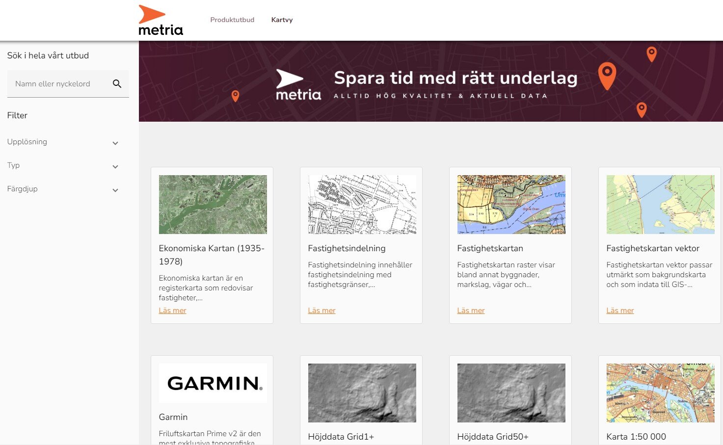
Our e-commerce offers a wide range of up-to-date and quality-assured geographic products such as raster and vector maps, orthophotos, elevation data and terrain shading. Newly added products are our Land Model and Property Report.
You choose and download the maps and images in the format you want and then manage them in your own software.

Our new e-commerce has an improved interface and more product information
- Fast - immediate delivery in the formats you want
- Easy - order via the map or product card and add to cart
- Accessible - always open, pay by card or invoice
Products in our e-commerce
In our online shop, a large selection of products is available in several formats and projections, more information can be found in the product cards in the service.
Map data presented in our e-commerce is partly based on information from Lantmäteriet and other public data providers.
The economic map is a register map that reports properties, register designations, residential buildings, land and garden, cultivation areas, ancient monuments and a large number of place names.
Read MoreMetria Fastighetsindelning contains property subdivision with property boundaries, property boundary points, administrative subdivision and register text from the Register Map.
Read moreThe property map raster shows, among other things, buildings, types of land, roads and property boundaries together with an orthophoto in the background.
Read moreMetria Fastighetskartan vektor is ideal as a background map and as input data for GIS applications. It is suitable for use in the scale ranges 1:1 000 - 1:20 000.
Read moreThe Prime v2 outdoor map is the most exclusive topographic map available for your Garmin GPS.
Read moreMetria Fastighetsrapport is a property peport that provide information about a property in the form of address, location, area, title deeds, registrations, rights, plans, tax assessment information and shares in joint facilities / communities .
Read moreHistorical orthophotos 1955-1970 and 1970-1985 contain scale aerial photographs and orthophotos in black and white with a resolution of 0.5 m and 1 m.
Read MoreElevation data ground model1+ is a gridded terrain model with coordinated elevation points in a regular grid with 1 meter resolution and high elevation accuracy.
Read moreElevation data ground model 50+ is a gridded terrain model with coordinated elevation points in a regular grid with 50 meter resolution.
Read moreMap 1:50 000 is a terrain map suitable for printing at a scale of 1:50 000 containing all the information needed for orientation in an area.
Read moreLaser Data NH consists of a point cloud with classified points based on laser data collected in 2009-2019 with a point density of 0.5-1 points per square meter, down to 0.25 points per square meter in cold mountain areas.
Read moreMetria Markmodell is a basic data package for those who need a land model with draped orthophoto together with buildings in 3D.
Read moreLand-use regulations include plans and regulations as well as ancient and cultural remains.
Read moreGer detaljerad och aktuell information om en skogsfastighet, inklusive data om skogsbestånd och markförhållanden.
Read MoreOrtofoto färgis a product with scale-accurate aerial image mosaics covering the entire country. The product is used as a valuable basis together with other geodata in many industries.
Read moreOrtophoto IR is a product with scale-accurate aerial image mosaics covering the entire country. The product is used as a valuable basis together with other geodata in many industries.
Read moreOrotofoto high resolution is a product with scale-accurate aerial image mosaics with higher resolution. The product has coverage in southern Sweden, along the Norrland coast and over a number of urban areas in the Norrland hinterland.
Read moreOrthophoto Black and White is a product of scale aerial image mosaics covering the whole country and containing the same information as Orthophoto Color but presented in a gray scale suitable as a background together with operational data.
Read moreMetria Rättigheter is a vector product that contains rights and common facilities and is a complement to the land division.
Read moreBox Description
Read MoreTopografi 10 is based on Lantmäteriet's basic geographic databases where the information has been collected with different quality in terms of positional uncertainty, content and timeliness.
Read moreTopografi 50 consists, among other things, of soil types, roads, paths, road barriers and contour lines (10 m equidistance in mountain areas and 5 m equidistance in the rest of the country).
Read moreTopografi 100 is ideal as a background map and as input data for GIS applications. It is suitable for use in the scale ranges 1:30 000 - 1:100 000. Topography 100 replaces our previous product Road Map.
Read moreTopografi 250 includes administrative boundaries, roads and railways, land classification and contour lines with a 25 m equidistance. It replaces our previous product, the Overview Map.
Read moreMetria Vägkarta provides an overview of roads & transportation together with e.g. soil types, elevation, waterways, infrastructure. Suitable for localization, transport planning, background map in the scale range 1:100 000.
Read moreMetria Översiktskarta provides an overview of the surrounding buildings, infrastructure and nature. It is suitable for localization, overview view or background map.
Read moreHow to shop in our e-commerce
Credit card customer – Fast and easy
Shop the basic range of raster maps and reports quickly and pay easily with a credit card. No commitment period – You create an account directly in the service and you are up and running quickly.
Sign a premium agreement and get access to the entire range!
As a premium customer, you get more products (also vector-based), the opportunity to subscribe to recurring orders, save your own data and choose between invoice or card. Maximize the benefit and streamline your work with Metria's e-commerce! An agreement costs SEK 1,500 per year and SEK 500 in start-up fee.
If you have any questions or would like to sign a contract, please contact kundservice@metria.se or one of our sales representatives.

Quickly
Immediate delivery in the formats you want.

It's easy
Select the area to order a map.
Available at all times
Always open, pay by card or invoice.
Get in touch with our experts!
More of our services
Metria Maps is a fast and stable mapping service that easily integrates into your business systems.
Read moreMetria Soil Model is a basic package of data for those who need a soil model...
Read moreMetria Property Report gives you information about a property in the form of: Address, Location, Area, Title...
Read moreGet in touch with us!
Want to know more or have questions? Feel free to contact us.


