Skip to content
kalmar-sesverige-small_ratio-16x9_2169x1220-2000x1125

Geodata and maps

kartnal-icon-1

Geodata for better and faster decisions

Organizations, authorities and companies in most industries make small and large decisions based on geodata on a daily basis. The information often comes in the form of, for example, map services and images from Metria.

That the information supply is up-to-date, relevant and quality-assured can apply to lives as well as large financial values. With our own, Sweden-based data center, we ensure both operation and quality of a range of services and products within geodata and maps.

TOUCH
Metria® Maps
Metria® Maps

Metria Maps är en snabb och stabil karttjänst som enkelt integreras i era verksamhetssystem. Användarna får tillgång till driftsäkra, uppdaterade och kvalitetssäkrade kartor, anpassade till vad ni behöver.
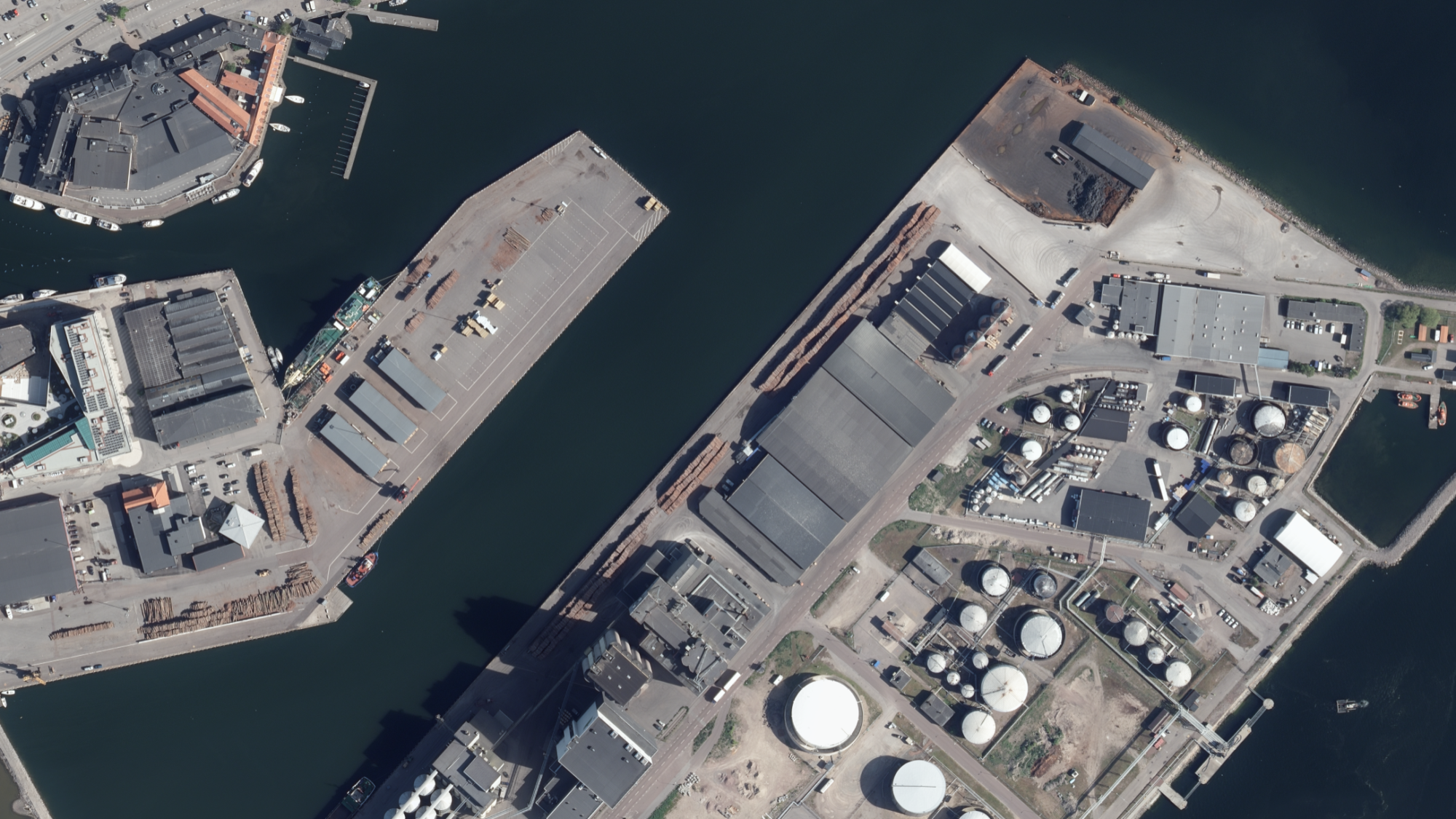
Läs mer
TOUCH
Metria® SeSverige
Metria® SeSverige

Metria SeSverige är en e-handelsportal där du snabbt och enkelt får leverans av kartor och bilder. Tjänsten innehåller ett brett utbud av ajourhållna kvalitetssäkrade raster- och vektorkartor, ortofoton, höjddata och terrängskuggningar.

Läs mer
TOUCH
Metria® Fastighetsrapport

Metria Fastighetsrapport ger dig information om en fastighet i form av: Adress, Läge, Areal, Lagfart, Inskrivningar, Rättigheter, Planer Bestämmelser och fornlämningar, Taxeringsuppgifter samt Andel i gemensamhetsanläggningar...

Läs mer
TOUCH
Metria® Markmodell
Metria® Markmodell

Metria Markmodell är ett grundpaket med data för dig som har behov av en markmodell med draperat ortofoto tillsammans med byggnader i 3D.

Läs mer
TOUCH
Metria geokodning
Metria geokodning

Det sägs att så mycket som 80 procent av alla data kan relateras till en geografisk position. Men många organisationer utnyttjar inte möjligheterna med positioner när de analyserar sina data.

Läs mer
TOUCH
Metria Fjärranalys och GIS

Genom att skapa, analysera, förädla och visualisera geografiska data bidrar Metria med värdefull information till företag, kommuner och myndigheter. Geodata ökar förståelsen för viktiga samhällsfrågor och leder till smarta och välinformerade beslut för alla typer av verksamheter.

Se hela erbjudandet
GEODATA FROM METRIA

Reliable information supply of all kinds of geodata

Metria handles, further refines, quality ensures and makes available daily large amounts of geodata from Lantmäteriet and other suppliers via our data center.

Effective handling Via our data center, large amounts of information are continuously delivered to our customers, both as physical deliveries and in the form of services that are integrated into system solutions. In the data center, we have built and further developed storage structures, processes, data management routines and code aimed at creating a quality-assured and efficient management of geodata. Everything to maintain a high level of quality in delivery to our customers. We also work actively to follow standards in the area.
High availability and quality A large part of an organization's competitiveness lies in access to the right information, with the right quality, at the right time. To ensure continuous delivery, Metria has developed a stable infrastructure with a high ability to handle disruptions and deliver services that can grow with the users' needs. With well-documented and standardized delivery processes, operations are ensured and the risk of errors is minimized. The process can also include processing, combinations of different data sources and processing. With our own premises in Sweden, we guarantee physical security for both development and operation. All employees are based in Sweden and, if necessary, we offer security-classified employees and premises. In the operating environment, there are multiple layers of protection in the form of secure firewalls for networks and application layers. We ensure continuity through redundant data centers and backup management. In the data center, we also handle customers' information in a secure manner.
Experts in geodata We are specialists in, among other things, geodata, GIS and remote analysis as well as IT development. With our combined expertise, we can offer complete solutions for your geodata management with the goal of ensuring maximum benefit and effect of geoinformation in the business. The solutions are always based on an analysis of your needs, which is normally a combination of open geodata, commercially available geodata, our self-produced analysis layers and your business data.
ISO-certified in information security Metria works systematically to maintain good quality, information security and sustainability. We are certified according to ISO 9001; quality, ISO 27001; information security and ISO 14001; environment.
Open data

Metria has extensive experience and deep knowledge of both geospatial data and earth observation and the environment and offers a variety of solutions and services in the area. We have also expanded our know-how in terms of companies and business ownership and can now offer an even broader portfolio and unique analyses. We help you with quality assurance, analysis and packaging of data into useful solutions to make it easier for you to reach your goals.

We would like to have a dialogue with you about what open data means to you and what we can do together to maximize the opportunities for you and your business.

istock-1172941079-1254x705-1024x576
Do you want to know more?

Contact our experts

TOUCH
Lena Lüning Product Manager geographic information

E-mail: lena.luning@metria.se

Phone: +46 10-121 85 42

Lena Lüning Product Manager geographic information
TOUCH
Sara Dahlén Account Manager

E-mail: Sara.dahlen@metria.se

Phone: +46 10-121 83 26

Sara Dahlén Account Manager

Please feel free to contact us!

Do you want to know more or have questions? Please contact us.