
Make better decisions with property information and geodata
- Finance and insurance
- Energy
- Infrastructure and construction
- Nature and environment
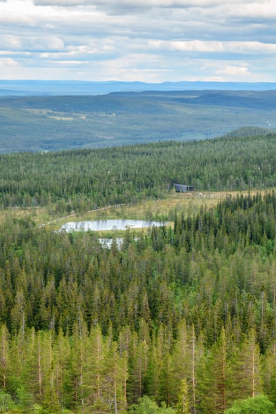
- Forest
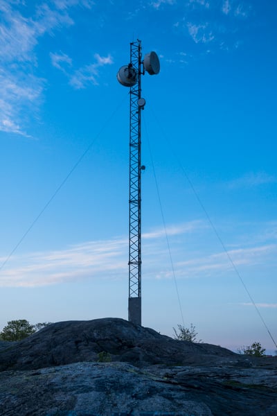
- Telecoms

Industry challenges:
In banking, finance and insurance, it is important to have accurate information when making credit decisions, risk assessments and setting premiums, for example.
Identifying and quantifying physical climate risks is increasingly important for banks and insurance companies.
Our solutions:
Quality-assured data combined with Metria's knowledge in real estate, business intelligence and analytics optimizes decision support and supports your business.
We provide support to banks and credit institutions in, among other things, the housing and real estate loan process, and insurance companies use the information as support, for example, when taking out insurance and in claims management.
Metria provides accurate analysis based on reliable geographic and economic data to gain control of the risks and how they should be managed now and in the future.

Industry challenges:
The energy industry is facing massive expansion, which requires efficient management of issues such as land access. Current working methods take time, contain broken digital chains and make it difficult to get control of the situation.
Geographic data, property information and map data are critical for making the right decisions in analysis, planning, preparation and management. It is not just a matter of showing consideration for nature, but new target images are emerging where biodiversity should be safeguarded and preferably increased.
Identifying the right counterpart at any given time is challenging, whether it is for consultation, drawing up land lease agreements or maintenance and management measures.
Our solutions:
Metria Markkollis a portfolio of ready-made IT services that support administrators and decision-makers in all matters related to land. We also provide energy companies with maps and property information for integration into other business systems throughMetria MapsandFastighetSök. Our experts in GIS and remote sensing also perform complementary consulting assignments.

Industry challenges:
The continued expansion in housing construction and increased demands for social, ecological and economic sustainability place great demands on Sweden's construction companies.
Quality-assured information, in a coherent and always accessible environment, is becoming increasingly important in the development of future cities and communities.
Our solutions:
By combining information from the map with your business information, you can efficiently plan construction and housing projects.
Our unique geodatabase is constantly expanding with new information and can be combined with your business data. This way,you can use geographic analysis to see new patterns and trends to support your important decisions.
Whatever your technology platform or IT system, we can help you combine your information with our standardized API services for map, property and business information, so you can make the right decisions.

Industry challenges:
Public authorities and businesses need ;
- access to quality-assured geographical information, mapping and analysis of land types, habitats and ecosystem services .
- information on land ownership in municipalities or throughout Sweden.
- mapping of green infrastructure as a basis for decisions on maintaining, managing and creating habitats that safeguard important ecosystem functions and natural processes .
Our solutions:
We help you with all types of spatial analysis to assess how you can contribute to a good environment and sustainable land use. Whether you need support in finding the right geodata on Sweden's nature and environment, want to collect or structure information, or need to make an analysis of the landscape, we can help you. We combine existing data and know how to best complement them to answer your question.
Industry challenges:
Need to support decisions, from ecosystem management to planning the supply of raw materials and developing financial ratios.
Need to know which companies are active in a specific area, or on a specific property, and retrieve contact information for companies (or individuals), we are happy to help with both area extraction and individual calls per property. Forexample, it may be a matter of identifying property owners in a certain area / project .
Recurring need to get a picture of business activity in different areas.
Our solutions:
We help many forest companies and large forest owners with our expertise in creating, analyzing, refining and visualizing geodata. Using artificial intelligence (AI) and remote sensing, we transform large amounts of data into valuable insights.
We now have the opportunity to include large amounts of business information in our existing products and deliveries. For you as a customer, this means that we can provide a larger part of your information needs to make the right decisions on a well-informed basis more easily and cheaply.
Industry challenges:
Need to ;
- know which companies are active in a specific area, or on a specific property, and retrieve contact details of the companies (or individuals ).
- identify stakeholders in a specific area or project
- get a picture of business activity in different areas
- accurately and cost-effectively calculate coverage when, for example, placing radio masts.
Our solutions:
We support telecom companies all the way from data collection and analysis to operation and management. We can develop geographic information systems (GIS), mapping services, package real estate information and solutions based on your business needs, or an IT support with a smart map at the center.Our long experience in system support and our business knowledge means we can develop a solution whatever your needs.
E-commerce for Maps and Geospatial Data
Order quality-assured geospatial data directly online. In Metrias e-commerce platform, you will find a wide range of products including raster and vector maps, orthophotos, elevation data, hillshade data, and terrain models — available in the format and coordinate system that suits your needs.
Fast delivery, up-to-date data, and reliable products for GIS, analysis, urban planning, and property development.
Read more about our e-commerce platform here.

If you are already a SeSverige customer, you can use the same login credentials in the e-commerce platform.
