For the valuation of forest and agricultural properties
Metria® Skogsanalys
Do you need up-to-date forestry data?
Valuing a forestry property requires knowledge, experience and good knowledge of the local market. Correct valuation is important, for example, in the event of a change of generation, dissolution of joint ownership, purchase or mortgage.
Much of the valuation is still done using paper maps and gathering information from many different sources. Metria Forest Analysis gathers all the necessary information in a simple and intuitive web service for analyzing forestry data. With up-to-date and fact-based data, the valuation of forest or agricultural properties becomes more accurate.


Improving quality
Easy to perform calculations and analysis on timber and volumes.

Reduces risk
Reliable data reduces the risk of misvaluation.

Saves time
Easy information retreival and administration.
How to analyze forest value with Metria Skogsanalys
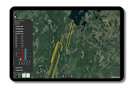
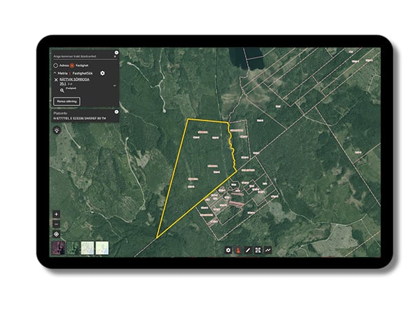
The service contains three different background maps, all with property boundaries, basic forestry data, tree height grids, protected nature and tree species distribution from NMD, National Land Cover Data.
The service contains three different background maps, all with property boundaries, basic forestry data, tree height grids, protected nature and tree species distribution from NMD, National Land Cover Data.
You can easily perform calculations and analyses to obtain timber volume, basal area, mean diameter, felling classes, harvests performed, felling notifications and felling statistics.
Search for a property and get a quick analysis of the most important forestry parameters, such as total wood supply and wood supply per hectare. In addition to volumes, you can also find out the tree species distribution, area distribution and roughly divided cutting classes.

Contact our experts!
E-post: daniel.fredriksson@metria.se
Telefon: 010-121 84 33
Knowledge articles for you
Mapping the entire Swedish land cover with satellite imagery
Geographic data crucial for firefighting
Soil moisture map of Sweden
Artiklar i kunskapsbanken
Så skapar organisationer värde med satellitdata
Geografisk information som beslutsstöd i kredit- och värderingsprocesser
Varför datakvalitet i geografisk information kan spara både pengar och miljö
More services
Metria GeoVis är en webbtjänst för att lätt tillgängliggöra och visualisera information om din verksamhet i en digital karta.
Läs merRedan idag kan vi leverera pålitlig och uppdaterad information om samtliga berörda parter i en samrådsprocess...
Läs merMed Metria Markkoll effektiviseras stora delar i kedjan från idé och projektering till samråd, beredning, markåtkomst och förvaltning...
Läs merContact us!
Do you want to know more or do you have questions? Please feel free to contact us.

