

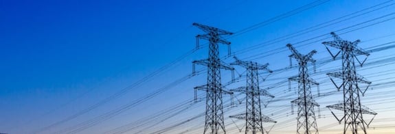
The electrification of society is driving growing demand for energy infrastructure and significant investment in its expansion.
When planning and expanding electricity grids, geodata is used to assess potential power line routes, ground conditions, property boundaries and environmental restrictions. Combined with GIS analysis, this information helps energy companies compare alternatives, identify affected properties and plan grid expansion.
Spatial data is used in several stages of energy infrastructure planning.
Read our guide on spatial data for energy and grid development →
Electricity network planning
When building new power lines or networks, energy companies need to analyze several factors.
For example:
- terrain and topography
- land use
- property boundaries
- natural and environmental constraints.
Geographical analysis allows organizations to identify suitable routes for power lines.
This type of analysis requires access to up-to-date geodata and analysis tools.
See how Metria works with geodata and analysis →
Property information in grid planning
Property data is used to identify:
- property boundaries
- landowners
- affected properties.
This information is important in the dialog with landowners and in permit processes.
Analysis of grid expansion
Geodata has become a key element in the planning, development and operation of energy infrastructure. GIS analysis makes it possible to:
- analyze alternative routes
- identify obstacles and restrictions
- optimize network structure.
Read more about how GIS and geographical analysis work →
By visualizing analyses in maps, organizations can create better decision support in planning processes.
Geospatial data has moved from being a support function to becoming a strategic resource in the energy sector.
This type of analysis requires access to up-to-date geodata and advanced analysis tools.
Learn more about Metria's geospatial analysis services -->
How does geodata influence decisions in electricity network planning?
Electricity network planning is about making complex decisions about investments, location and capacity. Geodata makes it possible to analyze land conditions, properties, environmental restrictions and climate impacts in context.
By using spatial analysis, energy companies can
- reduce the risk of inappropriate investments
- shorten project lead times
- streamline permitting processes
- plan robust infrastructure
Example: geodata in electricity network planning
An energy company can use geodata to:
- identify possible routes for power lines
- analyze soil conditions and topography
- identify properties and landowners
- avoid areas with environmental restrictions
The result is a more efficient planning process and better decision-making.
Want to learn more about how geodata and geospatial analysis can support the planning, expansion and management of energy infrastructure? Explore Metria's solutions for the energy sector.
Do you want to plan electricity networks more efficiently and analyze land, properties and risks with geodata?
Contact us and we will show you how it can be done in practice.