Metria Real Estate Map
The basis when you need to work with property information in an area - for planning, investigation and decision-making.

Product description 
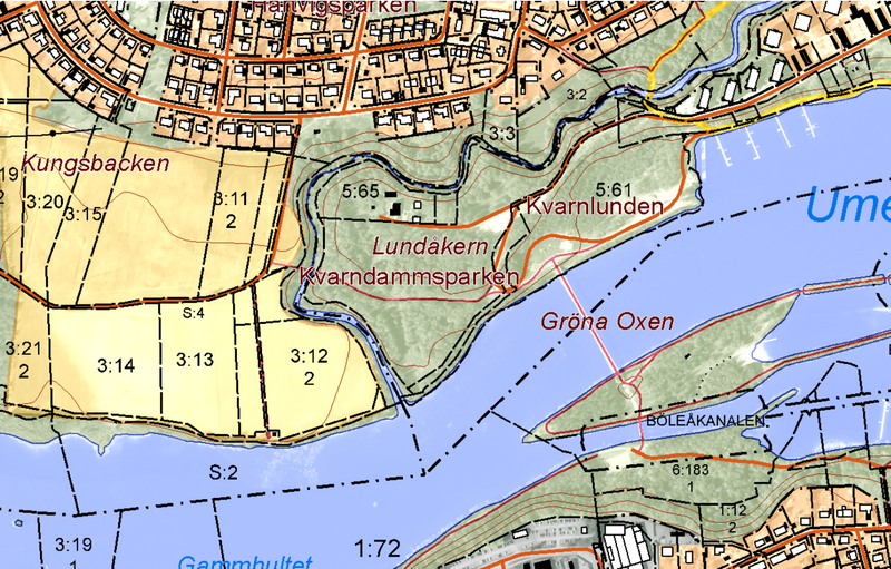
The raster property map shows, among other things, buildings, soil types, roads and property boundaries together with orthophotos in the background. The basis when you need to work with property information in an area - for planning, investigation and decision-making.
Raster: a ready-made map basis that is easy to use as a background/print and in many viewing environments. Suitable for quick overview and communication when you do not need to edit the objects.
You get: selected variant (raster or vector) and specification describing content, reference system, topicality and any limitations.
Common formats: Raster (e.g. GeoTIFF/PDF according to product selection), Vector (e.g. GPKG/SHP according to product selection).
Timeliness: The cadastral survey is updated every 14 days
Delivery format:Jpeg, Tiff, Google Earth KMZ
Contour lines: 5 m/extension
Resolution:1 m/pixel
Original scale:1:10 000
The cadastral classification is continuously updated by state and municipal land surveying authorities in connection with property formation. Some of these update the cadastral classification periodically.
The updating of the topographic objects is done in collaboration with the authorities or organizations responsible for each type of information. As a complement to achieving comprehensive updating of the information content, extensive periodic updating is also carried out in-house using photogrammetric methods.
The raster property map is the most detailed map that provides a good overview of the topography together with the link to the property division. The map is adapted to a scale of around 1:10,000 and is suitable as a background map for printing or for integration into your own system for further work.

Quickly
Immediate delivery in the formats you want.

It's simple
Order via the map or product card.
Available at all times
Always open, pay by card or invoice.
How to shop in our e-commerce
To shop in our e-commerce, you can choose between;
- payby card with access to raster products and reports and pay per purchase by credit card. You create an account directly in the service and you are quickly up and running.
- sign an agreement and become a premium user and you also get access to vector products and the option to choose more formats. You pay by invoice or card. An agreement costs SEK 1,500 per year and an initial fee of SEK 500.
If you have any questions or would like to sign a contract, please contact kundservice@metria.se or one of our sales representatives.

Get in touch with our experts!
More of our services
A changing climate affects the risk profile of climate-related events in society...
Read moreThanks to increased cooperation with the credit information company Syna...
Read moreHow can you most effectively find new customers? Who should you target with your next marketing offer?
Read moreGet in touch with us!
Want to know more or have questions? Feel free to contact us.