
A changing climate affects the risk profile of climate-related events in society, including through an increased frequency of extreme weather events. With geographical information, we can calculate where the risks are greatest and how these areas will be affected. Metria is an expert in mapping and analyzing both flood risk and ongoing flooding. This provides our clients with valuable knowledge and decision support that can be used for planning, risk management, climate adaptation measures, disaster management and much more.
Bluespot analysis: Identification of risk areas in the event of heavy rainfall
Metria has developed its own low-point mapping, also known as bluespot analysis. This analysis is used to identify areas where there is an increased risk of flooding during intense rainfall. These areas are low points on the ground where water accumulates and can quickly flood, causing damage to both buildings and infrastructure.
Threat maps for flood preparedness
On behalf of MSB, Metria has created so-called threat maps for large communities along the coast. These maps show the extent and depth of a coastal flood for a couple of different scenarios. Threat maps are used for community planning and climate adaptation action plans, among other things.
Flood mapping based on satellite data
Metria is also exploring innovative methods to improve flood mapping. By using radar data, which unlike optical satellite data is independent of clouds, Metria can quickly map flooded land and create a snapshot of affected areas. Satellite imagery can also be used to determine how long an area has been under water, which is crucial for assessing damage and planning response.
Metria Climate Index Property: An overview of climate risks
Metria offers the Metria Climate Index Property service, a national database that provides an overview of identified climate risks, including different types of flood risks. The database contains confirmed government information and analyzed information on sea level rise, flood risks linked to watercourses and risk of water accumulation during heavy rainfall (Bluespots). The service allows you to quickly assess the risks of individual properties and compare risks across larger property portfolios.
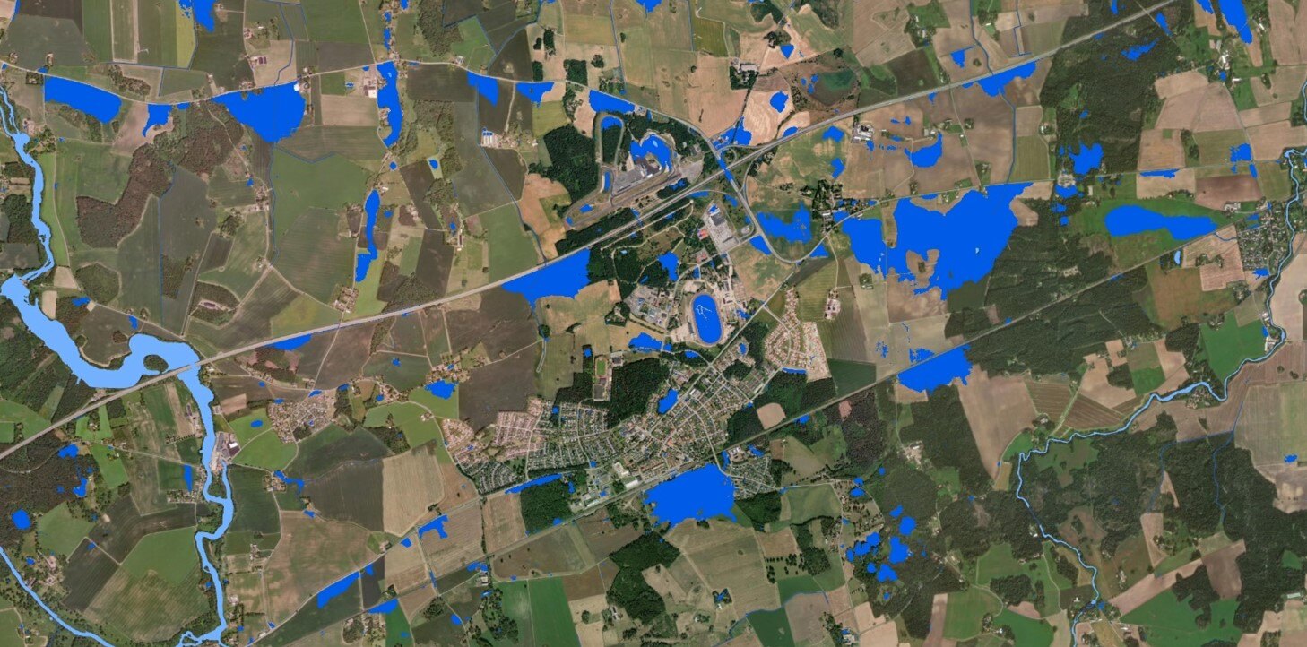
Bluespot mapping of Mantorp in Östergötland. Dark blue areas are Bluespots, light blue are rivers and lakes. During spring and summer, the area has been affected by flooding due to torrential rain.
More information about our services and how they can be used to minimize flood damage can be found here:
Analysis and advice - Turning data into knowledge (metria.se)
Climate-related risks - Metria Climate Index Property
Metria climate analysis for real estate and housing in Sweden