
Climate change is increasing the risk of fire. With the forest fires of summer 2018 fresh in our minds, we know that access to geographical data is crucial for firefighting.
The right insights at the right time protect people and animals and save large material values in the form of forests, land, houses from being lost. GIS (Geographical Information Systems) and remote sensing via satellite imagery are powerful tools for data collection, analysis and prioritization of fire response.
The right picture of the situation is crucial for response
Satellite imagery and remote sensing provide answers to crucial questions such as:
- Where is the fire?
- Has the fire spread?
- How will the fire develop?
Up-to-date data that is updated over time provides the emergency services, property owners, authorities and residents with the right decision-making basis to plan, act and prioritize. This in turn saves time and money in a crisis situation.
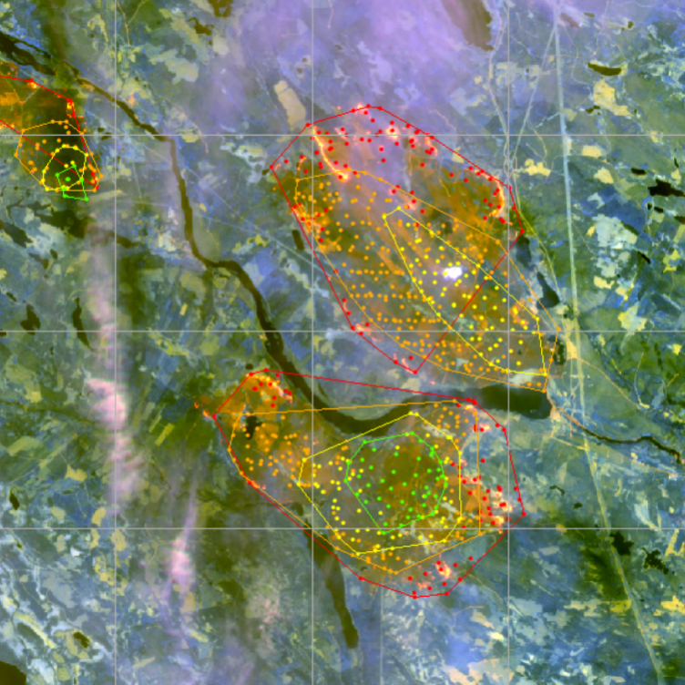
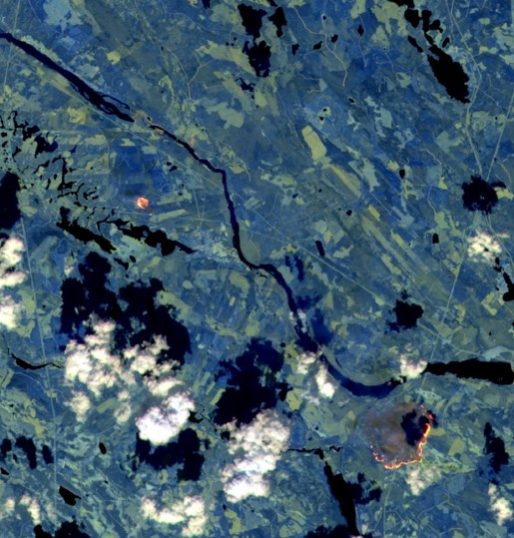
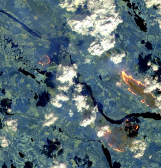
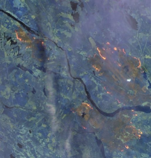
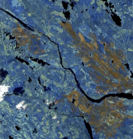
The course of the fire via satellite images
Below you can see the course of the fire around the village of Kårböle in Ljusdal municipality in 2018. The images are taken from the Sentinel 2 satellite, which is one of the satellites in the European Copernicus program.
|
The fire starts
|
Heavy spread
|
More areas
|
Large areas
|
What is the fire risk?
SMHI produces daily fire risk forecasts based on weather information, but the forecast does not take into account vegetation and its susceptibility to fire.
With the help of remote sensing, we can analyze the fire susceptibility of the land. The analysis combines different data sets from, for example, land cover mapping to classify the fire susceptibility of vegetation for Sweden.
The information is important as a planning basis to support decisions on risk management measures, preventive measures, planning of rescue operations or analysis and evaluation of fires.
Analysis of forest fire susceptibility provides answers to questions such as
- Which areas around the fire front are most prone to fire?
- Where should we create firebreaks to stop the fire?
- How will the fire spread?
- How much combustible material is in the forest?