Orthophoto in Metria Maps
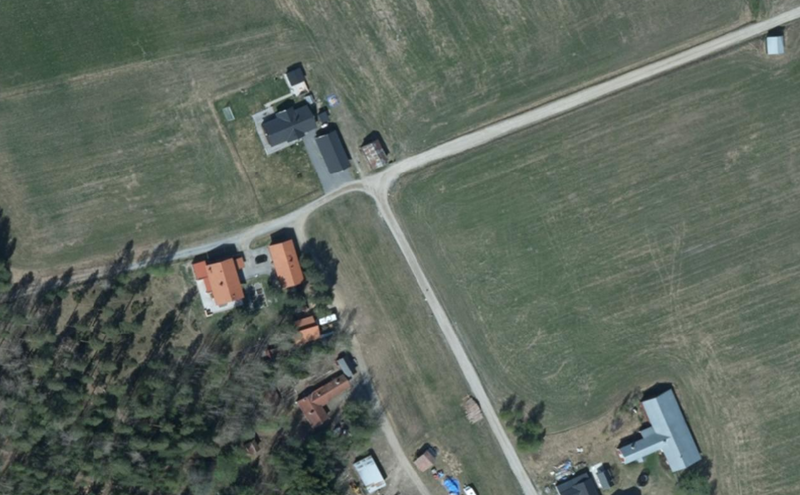
Orthophotos are geometrically corrected aerial images that are stitched together to create a true-to-scale representation of the ground. These images are free of the distortions normally found in aerial imagery, making them very useful for different types of mapping and analysis.
Our orthophotos in the Metria Maps service form a mosaic of the best possible resolution at each location, meaning you can get detailed and sharp images that are ideal for accurate analysis and decision-making. You can easily identify and analyze land use, which is crucial for planning, development and environmental protection.
|
High accuracy: |
Metria orthophotos are highly accurate and can be used to create detailed maps and situational awareness. They are useful in everything from forest inventory to urban planning and infrastructure projects |
| Timeliness: | Metria continuously updates its orthophotos, meaning that users always have access to the latest images. This is crucial to ensure that decision-making is current and relevant. |
| Versatility: | Orthophotos can be used in combination with other geodata to create an overall picture of an area. |
| Accessibility: | Metria's mapping services are easily accessible and can be integrated directly into users' systems. This makes it easy to use orthophotos in different types of projects and analysis. |
Orthophotos are often used in combination with other geodata and create a basis for spatial planning, environmental monitoring and land use planning and monitoring.
Some examples of uses:
- Background image for map reporting
- Inventory material for checking the timeliness of existing map bases
- Planning material for architects and street offices
- Presentation material for plans, decisions and ideas
- Presentation material for environmental impact assessments and localizations
- Materials for communication with the public and politicians
- Documentation for forest inventory, vegetation inventory and project planning
Articles in the knowledge bank
Från satellitdata till beslut – så upptäcks förändringar
När klimatrisker möter fastighetsinformation blir besluten bättre
Vilka klimatrisker påverkar svenska fastigheter mest?
More of our services
A changing climate affects the risk profile of climate-related events in society...
Read moreThanks to increased cooperation with the credit information company Syna...
Read moreHow can you most effectively find new customers? Who should you target with your next marketing offer?
Read moreGet in touch with us!
Want to know more or have questions? Feel free to contact us.