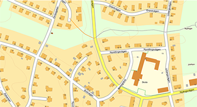
Real estate maps in Metria Maps
Metria Maps - Real estate maps
Metria Maps gives you access to a wide range of up-to-date and detailed real estate maps. Whether you work in property management, construction or legal, our maps give you the information you need, when you need it.
What do our real estate maps contain?
Metria Maps offers both overview and detailed map layers that make it easy to understand property conditions:
- Property boundaries
See the boundaries of each property. - Owner information
Access information about property owners, including contact details when available. - Building information
View details of buildings on the property, such as year built, type and use. - Historical maps
Compare how property boundaries and land use have changed over time.
Benefits of property maps in Metria Maps
- High accuracy
Maps are based on reliable and regularly updated data - Flexible use
We can adjust and customize map services according to users' needs. - Smooth integration
Metria Maps can be easily integrated into your existing systems and workflows via APIs.
Common areas of use
The property maps in Metria Maps are used by both private and public actors in several different situations:
-
Property management
Keep track of property inventory, plan maintenance and get an overview of ownership.
-
Real estate sales
Brokers and buyers can quickly get a clear picture of property boundaries and contents.
-
Energy companies
By using Metria Maps, energy companies can better plan and prioritize maintenance efforts, leading to increased efficiency and reduced costs.
-
Building and construction projects
Ensure the right data is used in project planning and execution.
-
Legal processes
Support contracts, cases and disputes where property boundaries or ownership information are crucial.
Try Metria Maps
Want to explore real estate data in an easy and accessible way?
Try Metria Maps - your digital map to better decision making.
Articles in the knowledge bank
Höjdkurvor 1 m – nyhet i Metrias e-handel
Tidiga beslut formar arkitekturen – därför är geografisk- och fastighetsinformation avgörande
Internationella våtmarksdagen: GIS & geodata stöd för restaurering och återvätning
More of our services
A changing climate affects the risk profile of climate-related events in society...
Read moreThanks to increased cooperation with the credit information company Syna...
Read moreHow can you most effectively find new customers? Who should you target with your next marketing offer?
Read moreGet in touch with us!
Want to know more or have questions? Feel free to contact us.

