
Climate risk, flood risk, and geographic risk are sometimes used as if they were the same thing. But these terms describe different things—and the differences become important when assessing risks for a property, a portfolio, or a business.
For example, flood risk can be part of physical climate risk. But a property that is not located in a flood zone is not automatically free from climate risk. And to understand how a physical risk actually affects a specific property, a geographic perspective is needed.
What is climate risk?
Climate risk is an umbrella term for risks arising from climate change and society’s transition to a more sustainable future.
A distinction is often made between physical climate risks and transition risks.
Physical climate risks relate to the consequences of a changing climate. Examples include:
- flooding
- torrential rain
- erosion
- landslides and rockfalls
- heat
- drought
- changing sea levels
Risks can be acute, such as during a heavy downpour, or develop over a long period of time through, for example, rising temperatures and sea levels.
Transition risks, on the other hand, concern the economic and operational consequences of the transition to a society with a lower climate impact, for example through changes in legislation, technology, or demand.
When analyzing climate risks in relation to real estate and geographic assets, it is primarily the physical climate risks that can be examined using geodata.
What is flood risk?
Flood risk is more specific. It describes the risk that an area or asset will be affected by flooding.
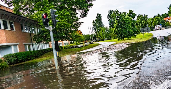
Floods can also have various causes. For example, they can occur due to high water levels in lakes and waterways, heavy downpours, or rising sea levels.
This means that an assessment of flood risk must take into account both the type of flood that could occur and where it could occur.
Flood risk is thus an important component of physical climate risk—but only one of several.
What is meant by geographic risk?
Geographic risk refers to how an asset or operation is affected by its location.
Two seemingly equivalent properties can have completely different risk profiles depending on, for example, proximity to water, soil conditions, topography, and exposure to various natural events.
The geographic perspective makes it possible to link information about a risk with information about what might be affected.
For a property, this might involve, for example, combining information about the property’s location with data on flooding, landslides, erosion, or other risk factors.
Geographic risk is therefore not a single climate risk in the same way that flooding is. Rather, it is a perspective for understanding where risks exist and which assets are exposed to them.
How are these concepts related?
A simple way to distinguish between them is:
Climate risk describes the broad range of risks associated with climate change.
Flood risk describes a specific physical risk.
Geographic risk helps us understand how different risks relate to a specific location, property, or asset.
It is only when risk data is combined with information about what is located at the site that the analysis becomes truly useful.
For example, a map of a risk area indicates where a flood might occur. By linking that information to property boundaries and other property data, it is possible to identify which properties are affected. For a larger real estate portfolio, the same principle can be used to analyze exposure across the entire portfolio.
Why isn’t it enough to look at a single risk?
Physical climate risk is location-specific and rarely consists of just one risk factor.
A property may have a low risk of flooding from a watercourse but at the same time be exposed to, for example, heavy rainfall, erosion, or landslides. Furthermore, the relevant risks vary between different parts of the country and between different types of assets.
Therefore, it is important not to equate climate risk with a single risk indicator.
By combining multiple types of geodata, it is instead possible to create a more comprehensive picture of geographic exposure—from a single property to an entire property portfolio.
From Risk Data to Decision-Making
For banks, insurance companies, property owners, and other organizations with geographically dispersed assets, the next question is therefore not only what climate risks exist, but also which assets are affected and what the overall risk picture looks like.
Geodata makes it possible to link climate-related risks to the right location and the right asset. This creates better conditions for prioritizing further analysis, preventive measures, and risk management.
At Metria, we combine geodata, property information, and geographic analysis to provide a basis for decision-making regarding physical climate risk. This can range from analyzing individual properties to identifying and comparing exposure across larger portfolios.
För mer information
About Metria
Metria offers digital solutions and services in GIS, geodata, real estate, and business information. Our offering covers the entire process—from identifying our clients’ needs for geodata, real estate, and business information to collecting, analyzing, and visualizing data to generate insights that lead to smarter, safer, and greener decisions.
Since spring 2022, Metria has been part of Spir Group, a Nordic group with approximately 260 employees in Norway and Sweden.
Spir Group is a Nordic company that simplifies unnecessarily complex processes by collecting and making information accessible to consumers, the public sector, and the private sector.
Spir Group is the parent company and the visionary force behind several software subsidiaries, all dedicated to delivering business-critical technology that sustains and advances society.
Our clients range from real estate agents, banks, insurance companies, appraisers, real estate developers, media companies, builders, property owners, engineers, and energy companies to manufacturers of building materials.
We are a team of more than 260 colleagues with deep domain and technology expertise. Spir Group does more than just collect and share information. We enable innovation and growth that strengthen trust between people, businesses, and society.
For more information about Spir Group, visitwww.spirgroup.com.