
AI is often described as a new technology, but in the field of remote sensing, AI—or machine learning—has been in use for decades. AI is an excellent tool for analyzing large amounts of geographic data more quickly, more consistently, and on a larger scale than is possible with manual methods.
Based on satellite imagery and other geodata, AI can help identify and classify features in the landscape. These may include tree species, habitat types, water bodies, or changes over time. The result is data that can be used for analysis, planning, and decision-making.
But how does the process of developing and using an AI model in practice actually work?
From Data to Final Analysis
Although the technology behind AI can be complex, the process often follows a fairly clear sequence.
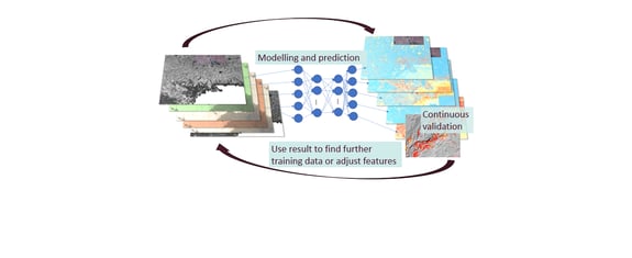
Data collection: Thefirst step is to collect relevant data such as satellite images, laser data, and other geographic information layers. The volume of data is often very large. A national mapping project can involve thousands of satellite images taken at different times. AI is particularly useful when it comes to handling large data sets that would be very difficult to analyze manually.
Training data: AI cannot automatically distinguish between forest, water, and built-up areas. First, the model must be provided with examples to learn from. This is where so-called training data comes into play. Sometimes data that can be used is already available, but often experts need to identify specific areas. For example, this might involve identifying certain habitat types in aerial or satellite images and labeling them. The quality of the training data is crucial. A model is only as good as the examples it is trained on. That is why a great deal of time is often spent ensuring that the training data is accurate, representative, and sufficiently comprehensive.
Training the model: Once the training data is in place, the model can begin training. During the training process, the algorithm analyzes patterns in the data associated with different classes. Gradually, the model learns to recognize differences between, for example, different types of forests, based on spectral values, textures, shapes, and other characteristics. The result is a model that can be applied to new areas where the classification is not yet known.
Production: Once the model is fully trained, it is used to analyze large datasets. This is where the real benefit lies. Instead of manually interpreting each image, the model can process large geographic areas in a short amount of time and create new layers of information that can be used in operations.
Quality assurance: The results must always be reviewed and quality-assured. Expert knowledge is essential for assessing whether the results meet sufficient quality standards and whether certain areas need adjustment.
Iteration and improvement: AI development is rarely a one-time effort. As the model is used, areas where it can be improved are often identified. New training data is collected, the model is retrained, and the results are re-evaluated. Through these iterations, accuracy gradually increases. In practice, this is often the most important part of the work. It is the interaction between domain experts, geodata, and AI models that produces the best results.
AI in Metria’s Remote Sensing Operations
Metria has extensive experience using AI within our remote sensing operations. We recognized early on the importance of combining remote sensing expertise with AI expertise, geodata expertise, and—not least—domain knowledge in nature, the environment, and climate. All of these areas of expertise are necessary to achieve good results.
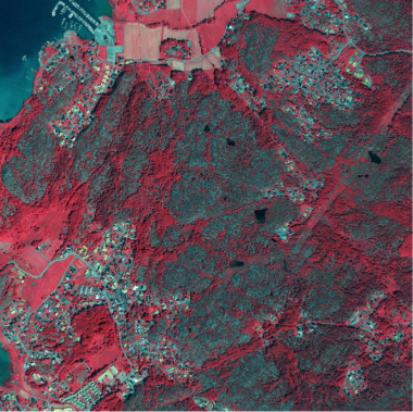
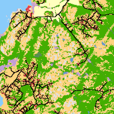
One example is the production of national land cover data (NMD), which we carry out on behalf of the Swedish Environmental Protection Agency.
NMD is a dataset that describes how the land is used and what is present in various locations across the country. Such surveys are time-consuming to produce and update. With the help of AI, large amounts of satellite data and other geographic data can be analyzed automatically. NMD is divided into a variety of classes, and for some of these classes, models are trained and then applied nationwide to classify land types across very large geographic areas in a consistent manner.
The result is up-to-date and detailed land cover data that can be used in urban planning, environmental monitoring, climate analysis, nature conservation, and infrastructure development.
AI as a Tool for Better Decision-Making
AI is a vital tool in many GIS and remote sensing projects. Its true value lies in the ability to transform large amounts of data into actionable insights that support analysis and decision-making. By combining expert knowledge, geographic information, and AI, we create more efficient processes and a stronger foundation for future decisions.
The journey from satellite data to decision-making still relies on human knowledge and experience. AI doesn’t do the work for us—but it helps us do more, faster, and with greater precision.
About Metria
Metria offers digital solutions and services in GIS, geodata, real estate, and business information. Our offering covers the entire chain, from identifying our customers’ needs for geodata, real estate, and business information to collecting, analyzing, and visualizing data to generate insights that lead to smarter, safer, and greener decisions.
Since spring 2022, Metria has been part of Spir Group, a Nordic group with approximately 260 employees in Norway and Sweden.
Spir Group is a Nordic company that simplifies unnecessarily complex processes by collecting and making information accessible to consumers, the public sector, and the private sector.
Spir Group is the parent company and the visionary force behind several software subsidiaries, all dedicated to delivering business-critical technology that sustains and develops society.
Our customers range from real estate agents, banks, insurance companies, appraisers, real estate developers, media companies, builders, property owners, engineers, and energy companies to manufacturers of building materials.
We are a team of more than 260 colleagues with deep domain and technology expertise. Spir Group does more than just collect and share information. We enable innovation and growth that strengthen trust between people, businesses, and society.
For more information about Spir Group, visitwww.spirgroup.com.